


Denver weather: Another day near 60 before snow on Thursday
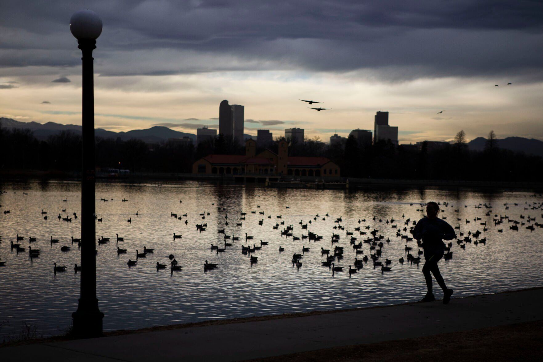
Another day of sun and unseasonably warm temperatures are on tap for Denver on Wednesday before snow moves in Thursday, forecasters predict.
The National Weather Service in Boulder said to expect a high near 60 degrees on Wednesday in Denver under mostly sunny skies.
That’s about 16 degrees warmer than the average high temperature for Jan. 7 in Denver, but it is not expected to reach the record high of 69 for this date, according to weather service records.
However, lows were expected to dip to 29 degrees overnight into Thursday ahead of some light snowfall across the metro area.
Meteorologists said to expect snowflakes to start falling on Thursday mostly after 11 a.m. The high Thursday is only expected to reach 40 degrees and the chance of snowfall is about 70%.
Forecasters said about 1-2 inches of accumulation is possible out at Denver International Airport by Friday morning.
Heavier snowfall impacts are expected in the foothills and south of Denver. The US 36 corridor between Denver and Boulder and areas east of that highway were not expected to be greatly impacted by the snow.
Areas such as Woodland Park and Monument Hill are expected to see “moderate impacts” from the snowfall on Thursday, which the weather service said could include hazardous driving conditions and possible road closures.
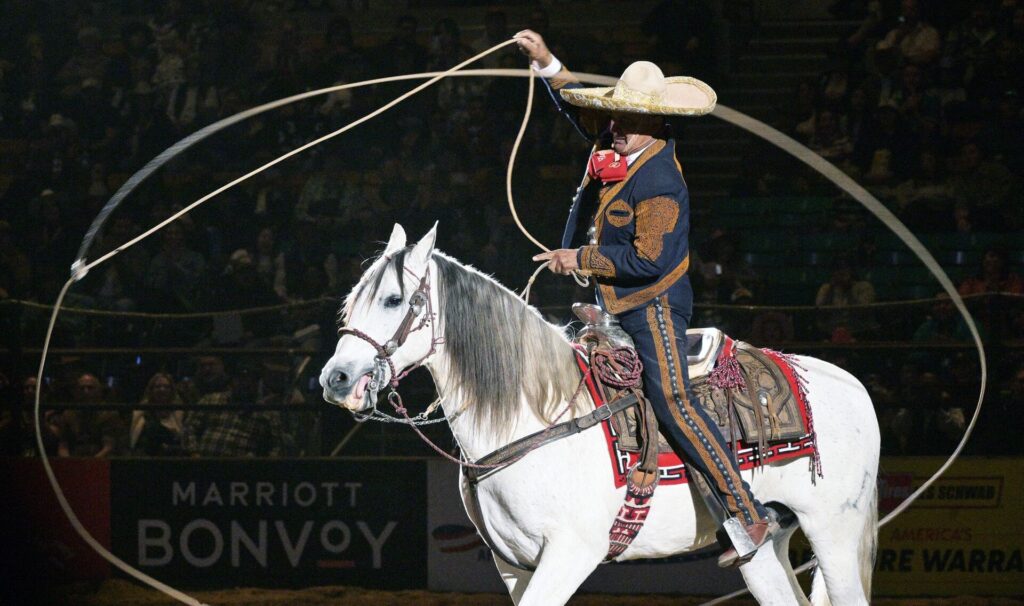
¡El aplauso! Mexican Rodeo Extravaganza marks 31st year in Denver
Deborah Grigsby
deborah.smith@denvergazette.com
Updated 3 hours ago
Rodeo lovers from across the country gathered Sunday afternoon at the Denver Coliseum for the National Western Stock Show’s Mexican Rodeo Extravaganza, a perennial favorite, now in its 31st year, hosted by World Champion Charro Gerardo “Jerry” Diaz. With a...
Deborah Grigsby
Reporter
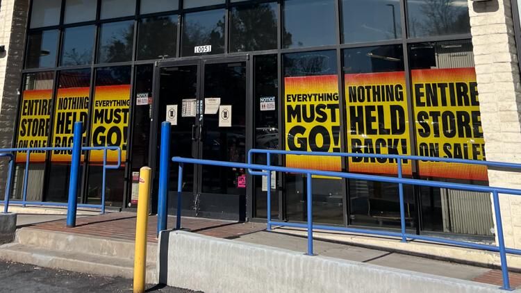
Sporting goods chain closing Colorado stores
9News
9news@denvergazette.com
Updated 10 hours ago
Signs at Big 5 Sporting Goods indicate plans to close multiple Colorado stores in Denver, Fort Collins, and Wheat Ridge. DENVER — Big 5 Sporting Goods is closing its doors to several stores in Colorado. The sporting goods store will shutter some...
9News
Reporter
PHOTOS: Crowds come to St. Benedict Monastery for Last Public Liturgy
Stephen Swofford
stephen-swofford@denvergazette.com
Updated 12 hours ago
Stephen Swofford
Reporter

1 arrested after shots fired during Denver traffic stop, shelter-in-place lifted
Deborah Grigsby
deborah.smith@denvergazette.com
Updated 8 hours ago
Denver Police have taken an adult male into custody after shots were fired at officers during an unrelated traffic stop late Saturday night in the Capitol Hill area near East 13th Avenue and North Logan Street. One bystander suffered a minor...
Deborah Grigsby
Reporter
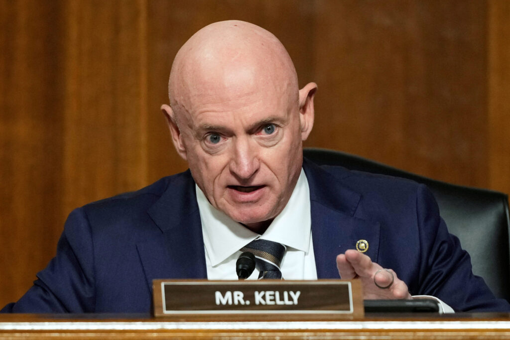
Colorado Springs veterans fear Hegseth’s censure of Sen. Kelly may silence military retirees
Mary Shinn
mary-shinn@denvergazette.com
Updated 2 days ago
After Secretary of Defense Pete Hegseth announced he planned to reduce Arizona Sen. Mark Kelly’s military rank and pay earlier, some Colorado Springs veterans said they feared it could discourage retired service members from sharing their own views publicly. In...
Mary Shinn
Reporter
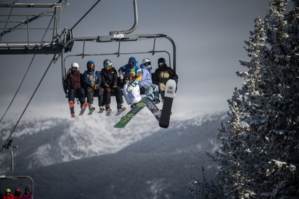
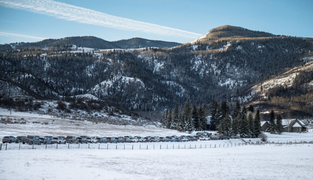
‘No Pain, No Jane’: Winter Park’s Mary Jane opens just in time to celebrate 50th birthday
Kyla Pearce
kyla-pearce@denvergazette.com
Updated 12 hours ago
Alli Salaman lifted her billowing red velvet skirt to step into her skis at the top of Winter Park Resort’s Super Gauge lift Saturday afternoon. Salaman was one of thousands of people who gathered at Winter Park’s Mary Jane for...
Kyla Pearce
Reporter

Telluride celebrates end to ski patrol strike
RACHAEL WRIGHT Special to The Gazette
rachael-wright-special-to-the-gazette@denvergazette.com
Updated 8 hours ago
The Telluride Ski Resort and the ski patrol union reached an agreement on Jan. 8, ending the longest ski patrol strike in U.S. history. Details of the agreement weren’t immediately released, and many remained worried about the economic damage to...

PHOTOS: Mary Jane Ski Resort Celebrates 50 Years
Stephen Swofford
stephen-swofford@denvergazette.com
Updated 1 day ago
Stephen Swofford
Reporter
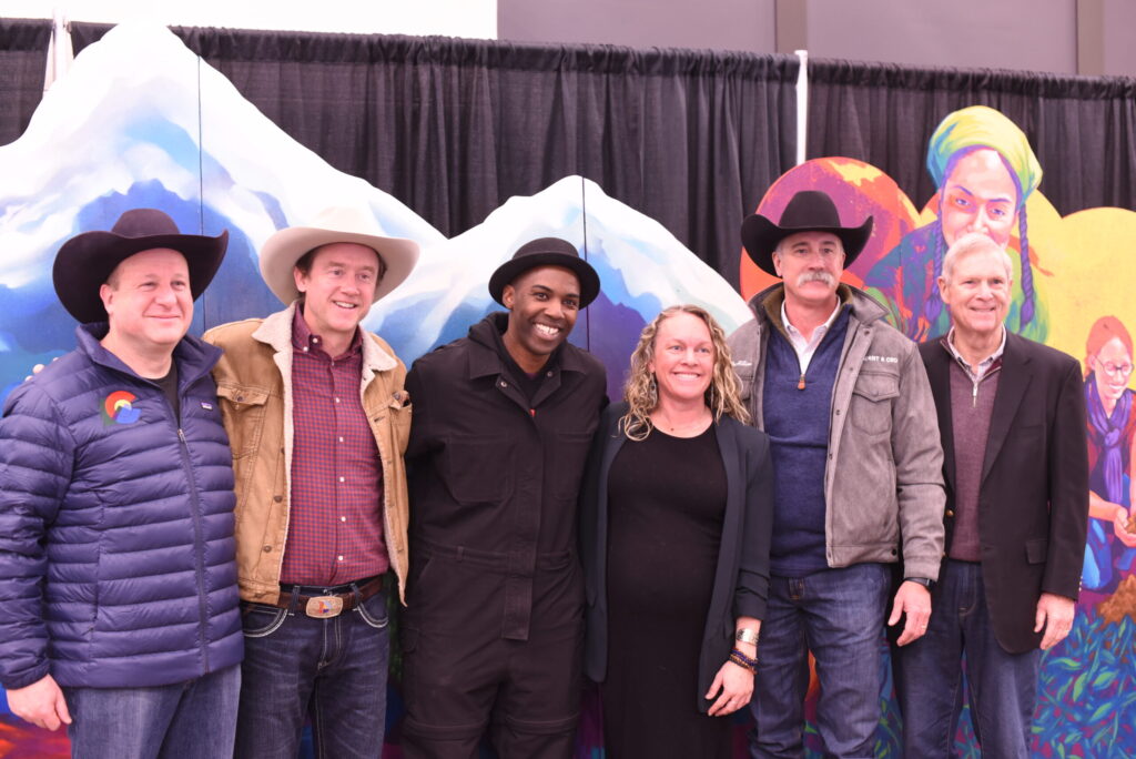
Polis, Johnston help unveil mural to the West to kick off Stock Show
Michael Braithwaite
michael.braithwaite@gazette.com
Updated 1 day ago
The 120th iteration of the National Western Stock Show kicked off Saturday morning by debuting a mural paying tribute to the American West. Unveiled in the second floor of the newly-opened Sue Anschutz-Rodgers Livestock Center, the mural, created by local...
Michael Braithwaite
Reporter
Frozen funds, vetoes and lawsuits: Why Colorado says it’s in Trump’s crosshairs
Thelma Grimes
thelma.grimes@coloradopolitics.com
Updated 1 day ago
Colorado Democrats have accused President Donald Trump of deliberately targeting their state, arguing his administration is using federal powers to punish it for its policies and resistance. But whether Colorado is being singled out — and why — depends largely...
Thelma Grimes
Reporter
PREV
PREVIOUS
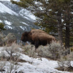
Colorado Parks and Wildlife building ‘bison roster’ for new potential hunting
Colorado Parks and Wildlife is building a list of prospective bison hunters ー a first for the agency as the iconic animal comes under new state management. Starting this year after the passage of Senate Bill 25-053, bison will be managed as big game wildlife in addition to their historic classification as livestock in the […]
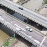
CDOT opens public comment on express lane plan for congested I-270 corridor
The Colorado Department of Transportation has opened public comment on proposed improvements to the congested Interstate 270 corridor, where heavy traffic, unreliable travel times and aging infrastructure create daily headaches for commuters and freight haulers. The department identified a preferred alternative that adds one tolled Express Lane in each direction along the six-mile stretch between […]