







1 snow storm misses, 1 hits Colorado next week | Whiteout snow report
Crazy pattern of cut-off lows resembles El Niño weather so far this fall
Colorado’s mountains are to miss out on a good snow-maker storm over the weekend, but will receive some snow from another one starting two days later.
Temperatures will remain cool heading into the weekend as well with the storm system’s passing.
Best chance for snow, and powder skiing and riding, is from the other storm system starting Tuesday, with most of the state’s mountains ready for another round.
Recap:
On Thursday, high temperatures peaked in the middle 40s across most lower-elevation bases and middle 30s at higher-elevation bases in Colorado’s mountains.
The recorded high from the National Weather Service in Boulder at Copper Mountain was 34. The high in Aspen was 53.
Forecast:
Today will be sunny, breezy and dry. Highs will be similar to Thursday, with middle 40s forecast at most base areas.
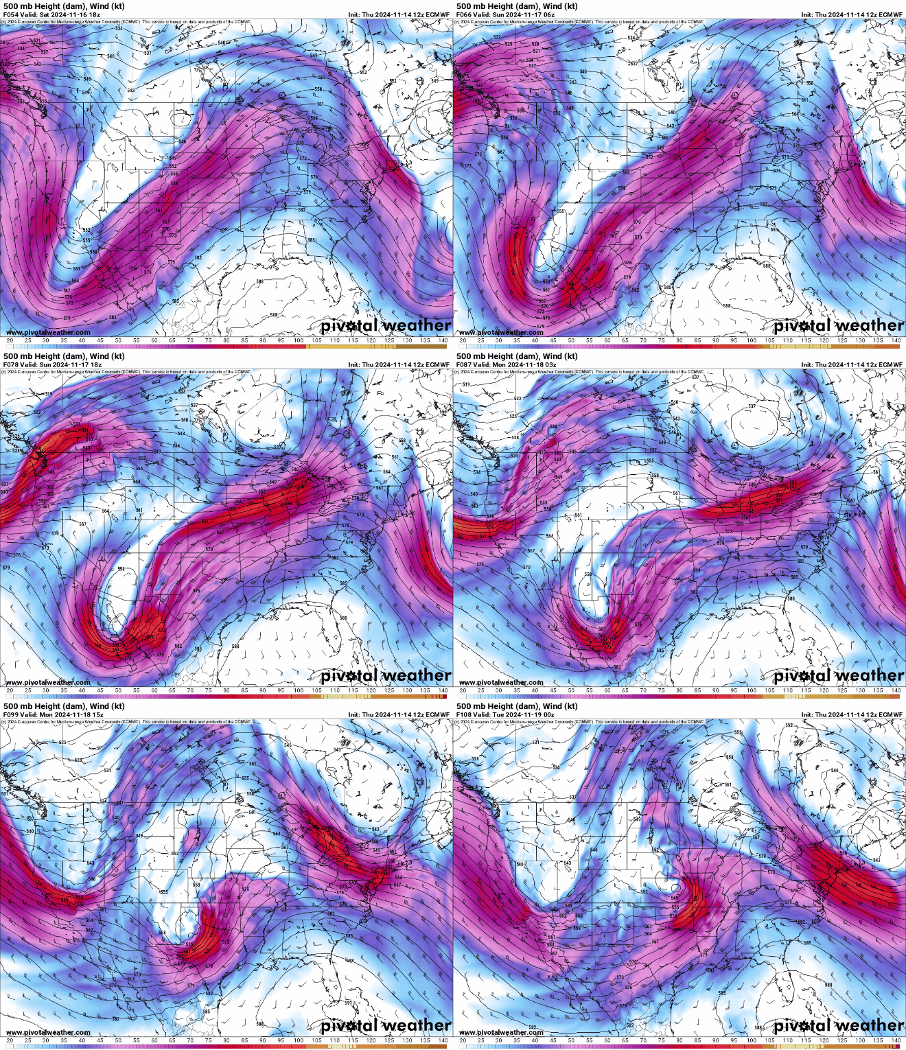
On Saturday (Purgatory’s opening day) and Sunday, what was supposed to be a solid snow storm for the mountains looks to take a more southerly route into Arizona and New Mexico, leaving Colorado with only a slight chance of snow in the mountains.
The storm is now forecast to cut off from the main west to east flow early Saturday morning and sweep across the desert southwest.
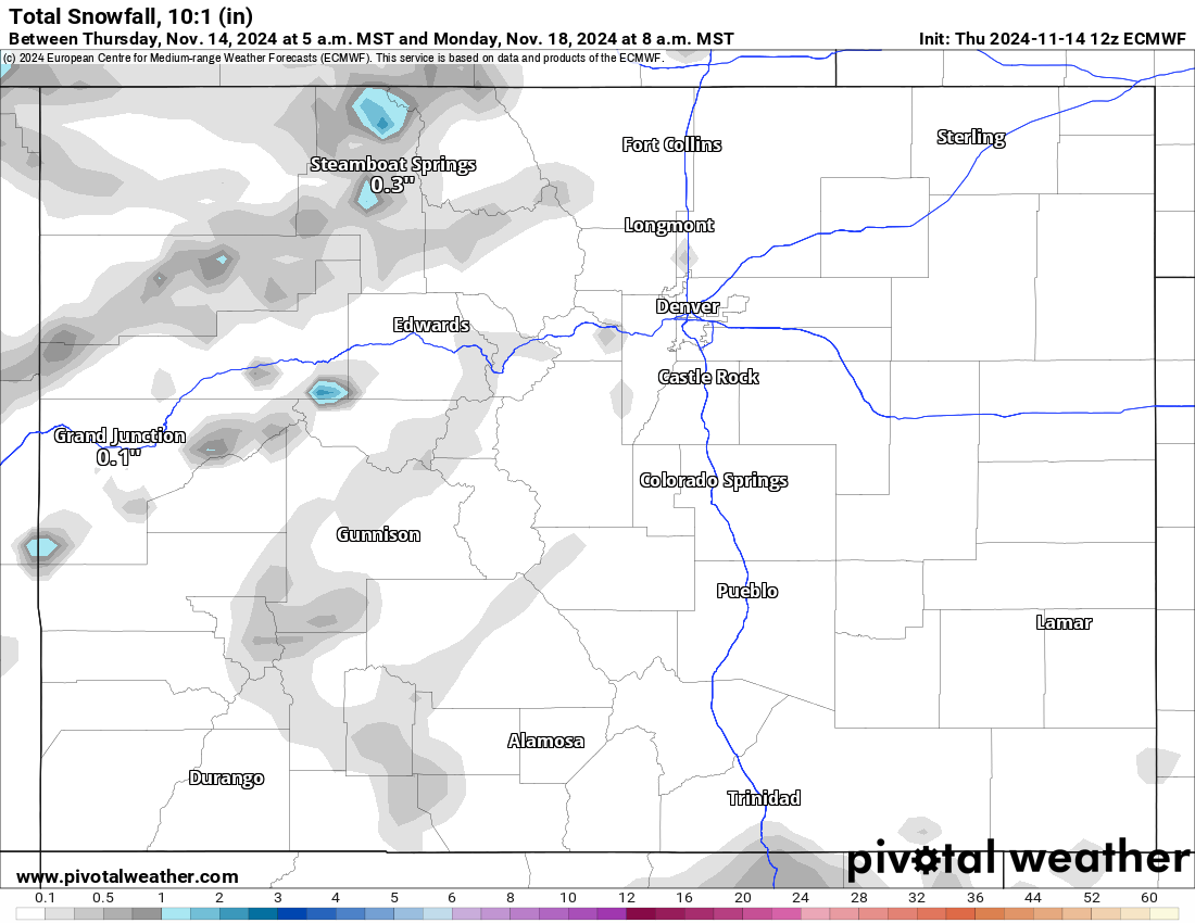
Total snowfall 10:1 (in) forecast amounts from multiple forecast models have only between a trace-2 inches of accumulation in Colorado, with the highest chance of snow near Steamboat in the Park Range and east of Trinidad near the New Mexico/Colorado state line.
Beginning Monday late night and overnight into Tuesday, a second storm system works itself further north than the weekend system into the Four Corners region, setting up better chances for snow in Colorado.
The ECMWF 500 mb Height (dam), Wind (kt) forecast model — a chart depicting the ‘spin’ in the middle atmosphere roughly between 16,000 and 20,000 feet — shows a very large swirling mass of wind, clouds and moisture pushing eastward. Unfortunately to some extent, the storm system won’t unload its full potential on Colorado’s mountains.
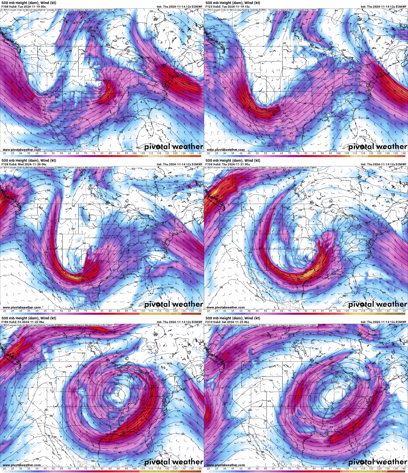
Like several of the previous storms this fall, this storm takes a southerly track — more typical in El Niño years — and is yet another cut-off low resembling a tropical depression or hurricane.
From Tuesday morning to Thursday afternoon, snow will fall across the entire state, however, the highest accumulations will once again be in the southeastern mountains of the Sangre de Cristo and Wet mountains.
Expected snow accumulations from the ECMWF Total snowfall 10:1 (in) model for the northern mountains range between 1-4 inches, in the central mountains between 1-4 inches, in the southwestern mountains between 1-3 inches and in the southeastern mountains between 2-12 inches, with the highest totals west of Walsenburg and around Trinidad.
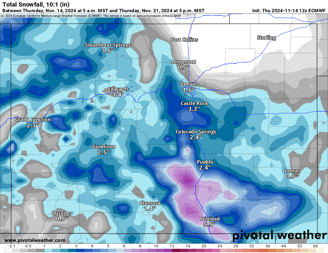
Overall, the best days for skiing and riding any fresh snow will be Wednesday and Thursday the farther southeast you go.
Long range:
Starting Thursday night a long dry period is forecast for Colorado and the western United States heading into the last week of November. Temperatures will remain cold, however, so snow should preserve over the long dry period.
Today’s 24-hour snow totals from Colorado resorts:
Arapahoe Basin – 0″
Aspen Highlands – Closed for the season
Aspen Mountain – Closed for the season
Beaver Creek – Closed for the season
Breckenridge – 0″
Buttermilk – Closed for the season
Cooper – Closed for the season
Copper Mountain – 0″
Crested Butte – Closed for the season
Echo Mountain – Closed for the season
Eldora Mountain – 0″
Granby Ranch – Closed for the season
Hesperus – Closed for the season
Howelsen Hill – Closed for the season
Kendall Mountain – Closed for the season
Keystone – 0″
Loveland – 0″
Monarch – Closed for the season
Powderhorn – Closed for the season
Purgatory – Opens Nov. 16
Silverton – Closed for the season
Snowmass – Closed for the season
Steamboat – Closed for the season
Sunlight – Closed for the season
Telluride – Closed for the season
Vail – Opens Nov. 15
Winter Park – 0″
Wolf Creek – 0″