


10-14 days of snow for Colorado’s mountains: Whiteout daily snow report, March 21
Only three more days of spring-like weather then winter returns to Colorado’s high country — and skiers and riders are in for a treat too. What once was a 4-6 day snow event is looking more like a 10-14 day snow event. Snow starts Saturday night and multiple storms will push through Colorado in the first few days of April.
Recap:
On Wednesday, weather around the state was mostly dry and calm, with temperatures in the 30s and low 40s. The high temperature in Breckenridge on Wednesday was 37.
A few showers popped up in the afternoon in and around the southern mountains, with Wolf Creek receiving some snow, but low energy is in the atmosphere currently leading to the lower amounts and more centralized snow shower spots.
Forecast:
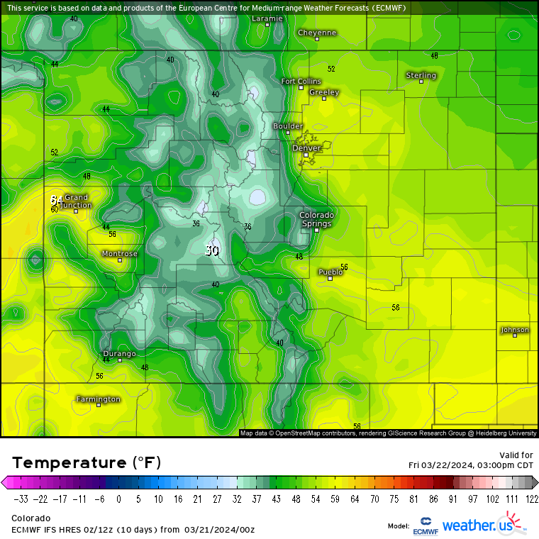
On Thursday, day time weather will be similar to Wednesday with high temperatures in the upper 30s and low 40s and mostly sunny skies; primo spring skiing and riding. On Thursday night into Friday morning a piece of storm energy brushing the northwestern corner of Colorado could bring 1-2 inches to the northern mountains.
On Friday, any new snow for first chairs will quickly absorb into the snowpack as sunny skies and warm temperatures return, but clouds will develop in the afternoon as typical for spring time weather.
On Saturday morning, it will be pretty much the same as Friday, however, gusty conditions will exist and more clouds will stream in ahead of the moisture heavy first wave of winter-like storms.
Long Range:
Starting Saturday night, multiple storms will cross Colorado bringing a significant amount of snow over a 10-14 day period and several powder days along with it.
Snow will start in the southern, northwestern and western mountains Saturday night and continue through Sunday. Sunday will be a storm day and accumulations by last chair could be sizeable.
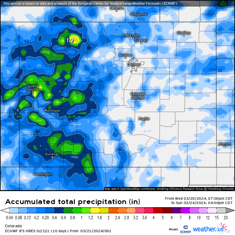
The ECMWF high resolution model forecasts snow accumulations for the northwestern mountains range between 6-20 inches, in the western mountains between 6-16 inches, in the central mountains between 6-10 inches, in the southern mountains between 4-12 inches and the northern mountains between 1-6 inches.
Snow will continue into Monday and first chairs everywhere will be soft or deep (further west one goes) for skiing and riding.
The Front Range, Sangre de Cristo and Wet mountains, and eastern foothills and mountains will see snow accumulations between 4-12 inches.
Snow continues on Tuesday through Friday with amplified snow on Wednesday and Thursday. Another 10-20 inches is forecast to accumulate by Friday for the northern, central and southern mountains, however, lesser amounts between 4-8 inches is forecast for the eastern mountains.
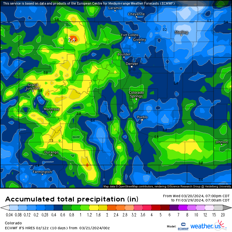
The grand totals’ map above is snow accumulations from Sunday to Friday. Accumulations between 12-24 inches is possible according the ECMWF high resolution model run from Thursday evening. Powder days should be Monday, Thursday and Friday with storm days being Sunday, Tuesday and Wednesday.
Friday and Saturday will mostly cloudy to partly sunny before the next system hits the California coast on Sunday, with the third wave entering Colorado early next week.
More details for storms after Sunday will be updated in the next few days’ snow reports, but Colorado and its snowpack are looking to get a serious boost heading in Easter weekend and the first few days of April.
Today’s 24 hour snow totals from Colorado resorts:
Arapahoe Basin – 0″
Aspen Mountain – 0″
Aspen Highlands – 0″
Beaver Creek – 0″
Breckenridge – 0″
Buttermilk – 0″
Cooper – 0″
Copper Mountain – 0″
Crested Butte – 0″
Echo Mountain – 0″
Eldora Mountain – 0″
Granby Ranch – 0″
Hesperus – Closed for season
Howelsen Hill – 0″
Kendall Mountain – 0″, open weekends
Keystone – 0″
Loveland – 0″
Monarch – 0″
Powderhorn – 0″
Purgatory – 0″
Silverton – 0″
Snowmass – 0″
Steamboat – 0″
Sunlight – 0″
Telluride – 0″
Vail – 0″
Winter Park – 0″
Wolf Creek – 2″