25″ of snow in 24 hours at central Colorado ski area | Whiteout snow report
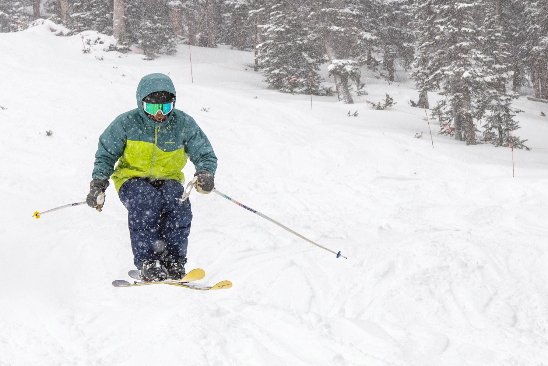
Beaver Creek and Crested Butte open today to POWDER
From Steamboat to Silverton and Powderhorn to Loveland, snow accumulations in the last 24 hours have made for some excellent skiing and snowboarding in Colorado’s high country.
Snow ends Wednesday afternoon, but not until another 3-7 inches falls across Colorado’s mountains.
Soft snow for Thanksgiving and likely lots of new terrain will open up ahead of Black Friday and the weekend.
Recap:
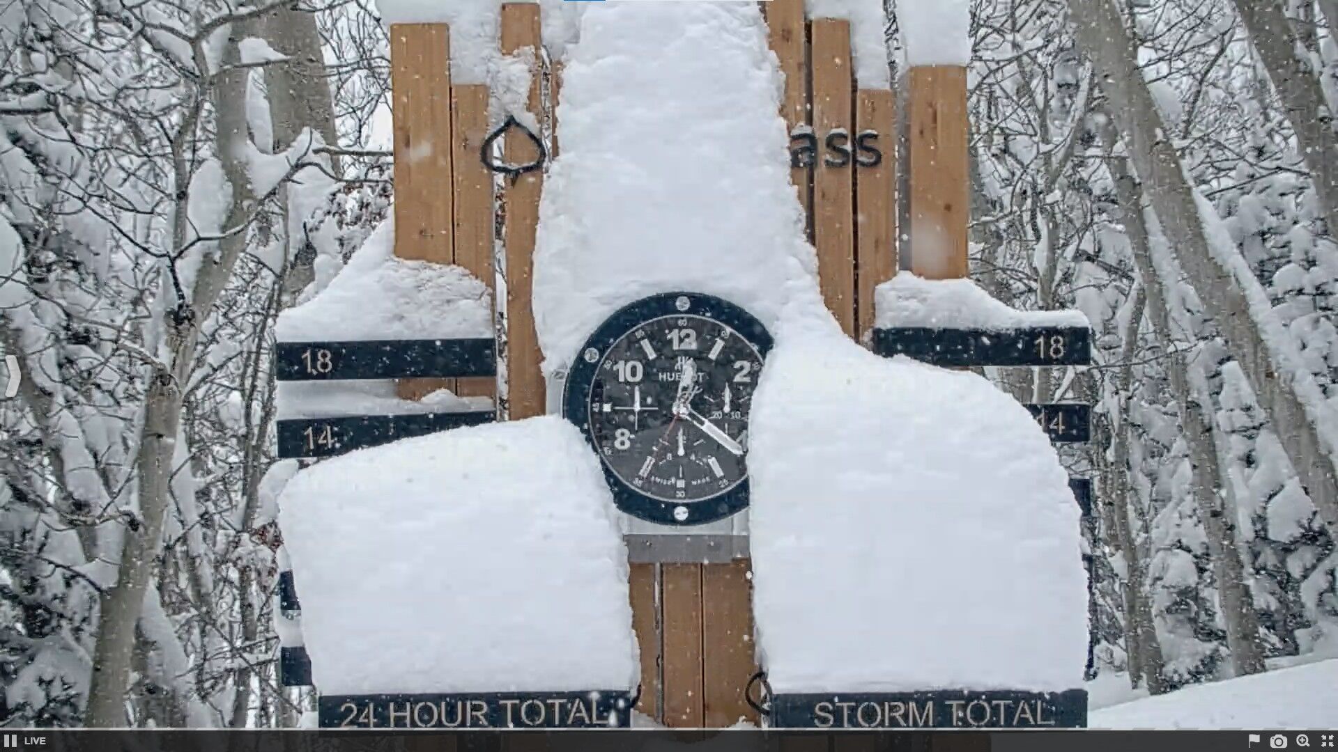
Snow started falling in Colorado shortly before midnight Monday and continued all day Tuesday. Skiers and riders woke up to between 2-7 inches at many ski areas and resorts, with the higher totals in the west central and west northern mountains. Snowmass had 6 inches at 6 a.m. and about 9 inches at first chair.
Heavy snow fell throughout the day Tuesday, with the snow stake camera at Snowmass capturing 14 inches of snow in approximately 14 hours (midnight to 2 p.m.). Snowfall rates of 1 inch per hour were common at other locations around the state too.
From 4:30 a.m. to 4:30 p.m., it snow about 10 inches at Copper Mountain and Crested Butte and about 8 inches at Steamboat. Monarch Mountain recorded 18″ of snow in 18 hours but nearby Crested Butte recorded 25″ in 24 hours!

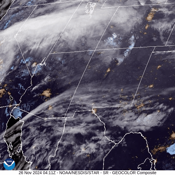
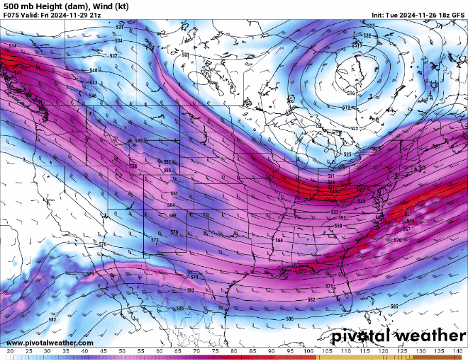
The atmospheric river brought in ample moisture on a west-to-east zonal flow straight across the middle of Colorado. Clouds funneled in late Monday night and steadily dropped snow all day Tuesday.
The Bomb Cyclone affecting the Pacific Northwest last week is feeding its remnants across Utah and Colorado this week, giving much-needed moisture to almost every western state.
Temperatures at most ski area base areas were on the warmer side too. The National Weather Service in Boulder recorded a high of 26 at Copper Mountain on Tuesday.
Forecast:
On Wednesday, snow will continue most of the day on the same atmospheric river flow.
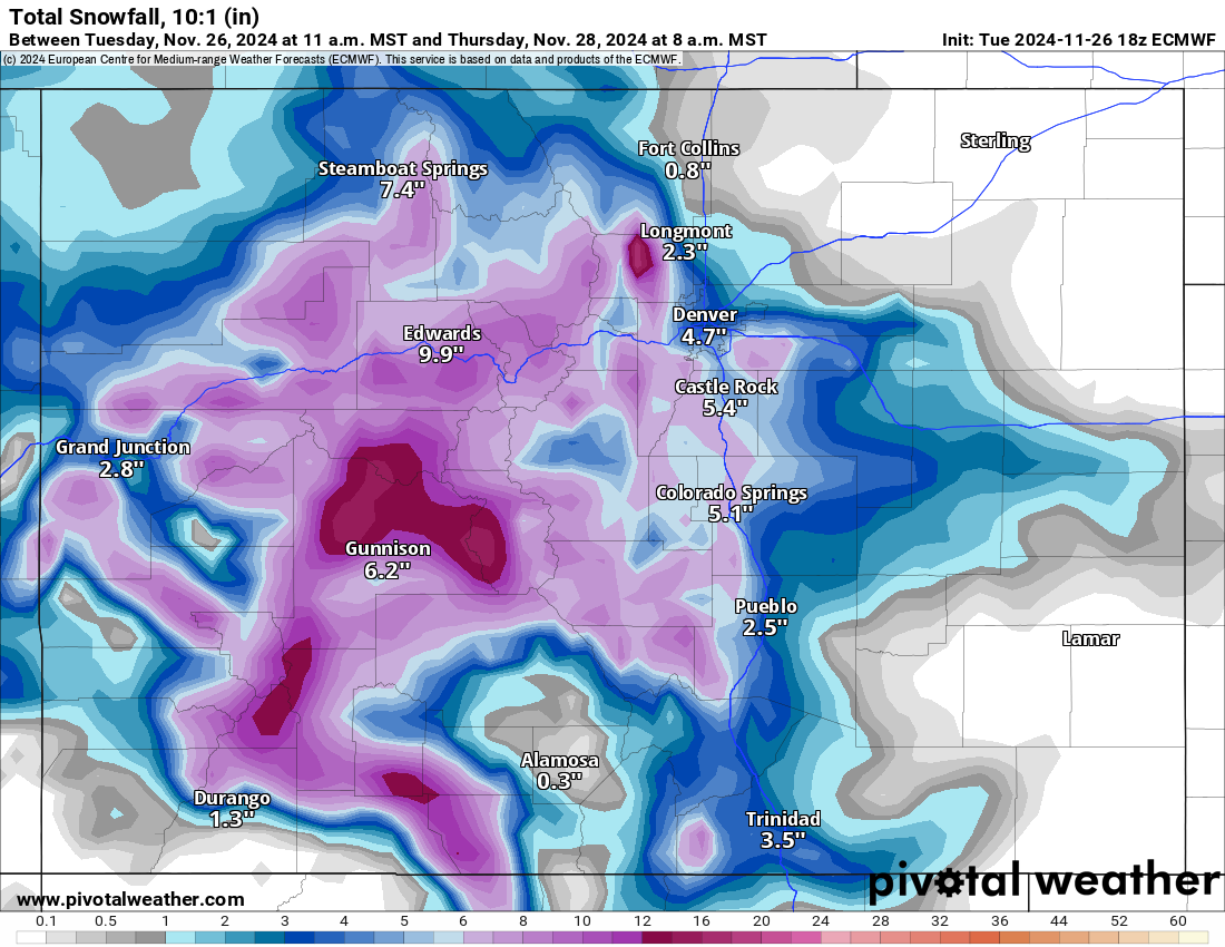
Snow accumulations on Wednesday in the northern mountains range between an additional 10-16 inches (northwestern) and 12-20 (eastern), in the central mountains an additional 12-18 inches, and in the southern mountains an additional 16-22 inches.
The European model still has conservative accumulations falling, however, the NWS Blend model forecasts the totals above.
The ECMWF model:
The NWS Blend of Models model:
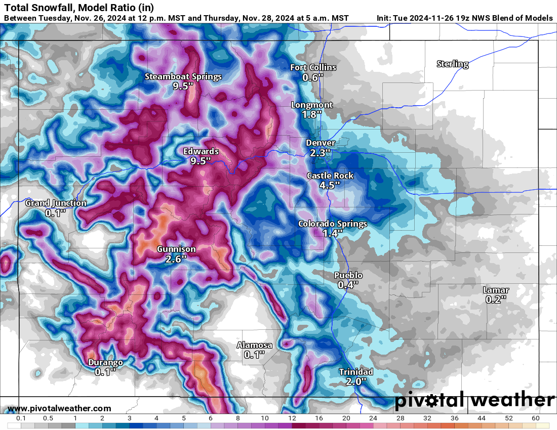
Even if the models are averaged, 10-20 more inches of snow should accumulate by first chairs Thursday, rebounding Colorado’s snowpack upward from around 105% on Monday to perhaps 130-140% of average.
On Thanksgiving, Black Friday, and both weekend days, the forecast calls for sunny skies, drying and warming conditions each day, with highs in the 20s and 30s.
Long range:
The first 7-10 days of December are not looking very stormy at all. After the Thanksgiving week storm system, the jet stream pushes northward into Montana, taking the moisture with it.
From Friday to Thursday, Dec. 12, Colorado looks pretty bone dry, with only a potential cut-off low forming in northern Mexico around Dec. 5. However, this system will stay well south of Colorado, limiting potential snows for southern Colorado.
The northern half of the state is forecast similarly as the jet stream stays in Montana and Wyoming, with promising winds but limited moisture only grazing mountain areas around the Wyoming/Colorado border.
More details will emerge as December arrives, but skiing and snowboarding fresh snow might be on hiatus for the first bit of December.
Today’s 24-hour snow totals from Colorado resorts:
Arapahoe Basin – 15″
Aspen Highlands – Opens Dec. 14
Aspen Mountain – Opens Nov. 28
Beaver Creek – 17″
Breckenridge – 18″
Buttermilk – Opens Dec. 14
Cooper – Opens Dec. 11
Copper Mountain – 20″
Crested Butte – 25″
Echo Mountain – Opens in December
Eldora Mountain – 9″
Granby Ranch – 5″
Hesperus – Closed for the season
Howelsen Hill – Opens Nov. 30
Kendall Mountain – Opens Dec. 20
Keystone – 14″
Loveland – 14″
Monarch – 19″
Powderhorn – 9″
Purgatory – 12″
Silverton – Opens Dec. 28
Snowmass – 22″
Steamboat – 15″
Sunlight – Opens Dec. 13
Telluride – Opens Nov. 28
Vail – 20″
Winter Park – 18″
Wolf Creek – 18″