


Forecasted snow totals up to 36″ by Black Friday from Thanksgiving-week snow event | Whiteout snow report
Forecast models are in better agreement about the multi-day snowstorm event during Thanksgiving week, which is forecast to lay down a good amount of snow from Sunday morning to Friday across Colorado’s high country.
Multiple snow and powder days are forecast for all three mountain zones, with snow moving from north to south starting Sunday.
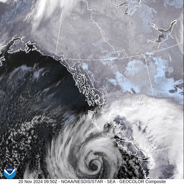
Residual moisture from the Pacific Northwest ‘Bomb Cyclone’ will push into the central Rockies helping fuel Colorado’s snowy week.
Recap:
Conditions across Colorado’s mountainous areas on both Wednesday and Thursday were as forecast; dry, warming each day, and some wind. The recorded high from the National Weather Service in Boulder at Copper Mountain was 27 on Wednesday and 37 on Thursday.
Forecast:
Friday and Saturday are forecast to be warmer and equally dry as a high-pressure dome continues over Colorado and the Four Corners states.
Forecasted winds will be light due to the low pressure in the Midwest, now in the Ohio River Valley, too far east to bring any down-sloping, northwestern winds behind it into Colorado.
On Sunday the storm arrives and the shift takes place for multiple snowy days.
Here’s the breakdown:
• Snow begins Sunday afternoon in the northwestern and northern mountains, bringing the potential for respectable totals for Monday’s first chairs, with the storm’s edge staying mostly north of Interstate 70.
The ECMWF Total snowfall 10:1 (in) forecast model has snow accumulations of approximately 1-4 inches.
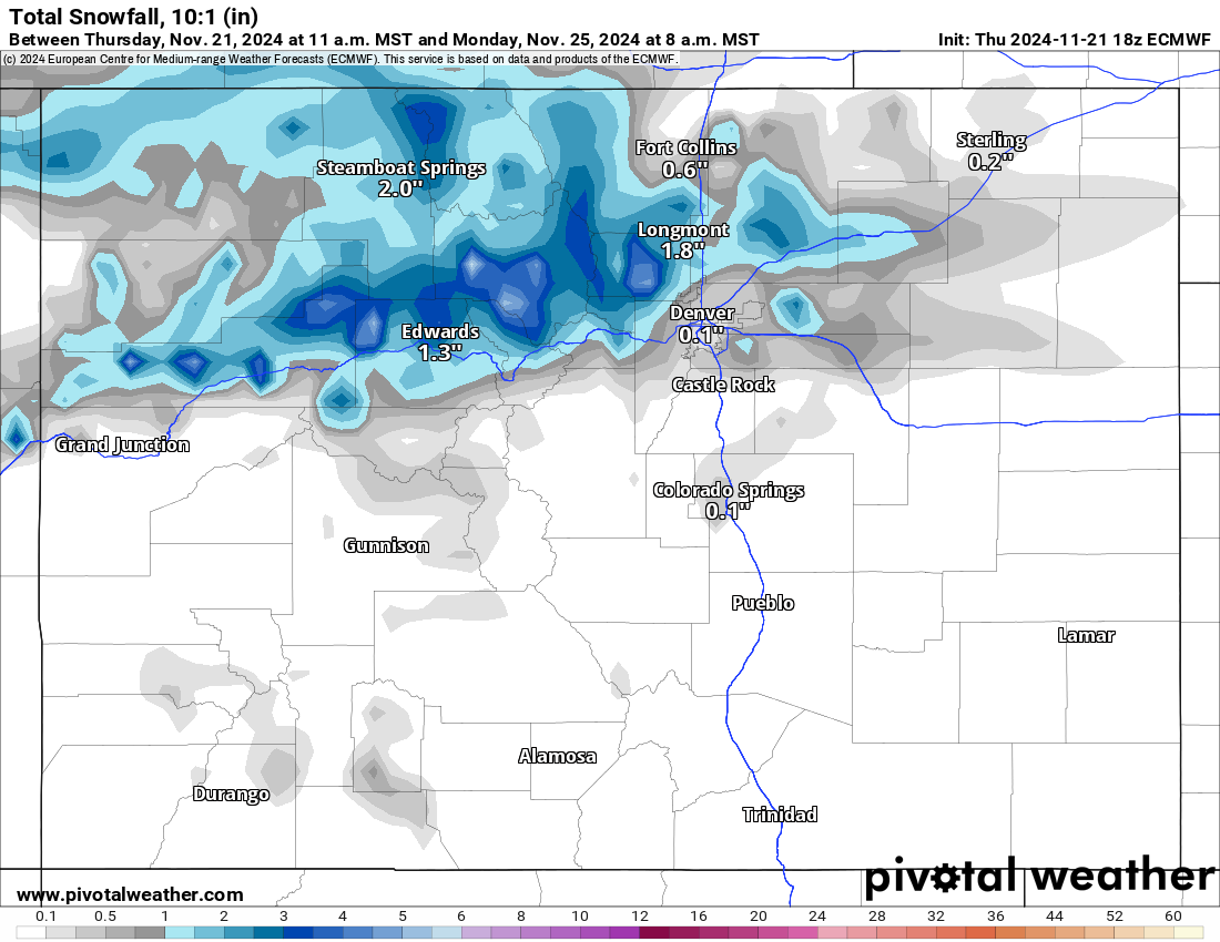
A probable light powder day is in order at Steamboat, Winter Park, Eldora, Arapahoe Basin and Loveland. Lesser, but still some, new snow should be at Keystone, Copper Mountain and Breckenridge.
• Monday offers a down day in the action, but another wave moves in after sunset into Tuesday, and is forecast to bring a lot more moisture to all of the state’s mountain zones.
This storm looks warmer than some, with temperatures forecast to be in the upper 20s for highs, meaning the potential for wetter snows could fall during the snow event.
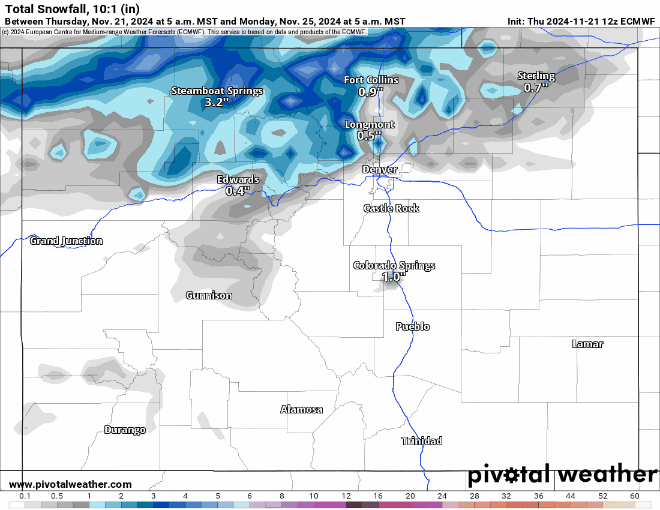
The ECMWF Total snowfall 10:1 (in) forecast map loop below shows how snow pushes and accumulates across Colorado from late Monday night into late Wednesday night, especially south of I-70.
Total storm-snow accumulations from the NWS Blend Total snowfall 10:1 (in) forecast model are projected for an additional 8-18 inches for the northern mountains, between 5-25 inches in the central mountains, and 10-35 inches in the southern mountains.
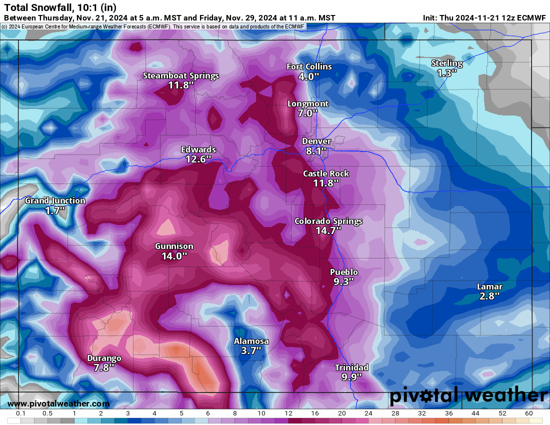
Powder days are Tuesday, Wednesday, and Thursday, with deeper accumulations south of US Hwy 50 each day as the storm pushes moisture in on a west-northwest flow.
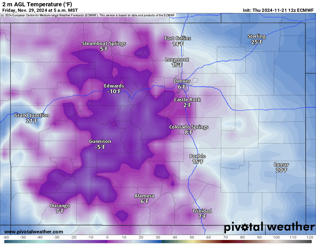
Thanksgiving Day will be the coldest day of the snow event cycle.
• The storm will begin exiting Colorado on Thanksgiving Day, leaving Black Friday a leftover day, but very cold as arctic air takes hold over a large portion of the Rocky Mountain states, including Colorado.
Long range:
The potential for snowy conditions on Saturday, Nov. 30, and Sunday, Dec. 1 is possible, but with that time frame 7-9 days out, better details will come to the surface as more model runs are done over the next 3-4 days.
Today’s 24-hour snow totals from Colorado resorts:
Arapahoe Basin – 0″
Aspen Highlands – Closed for the season
Aspen Mountain – Closed for the season
Beaver Creek – Closed for the season
Breckenridge – 0″
Buttermilk – Closed for the season
Cooper – Closed for the season
Copper Mountain – 0″
Crested Butte – Closed for the season
Echo Mountain – Closed for the season
Eldora Mountain – 0″
Granby Ranch – Closed for the season
Hesperus – Closed for the season
Howelsen Hill – Closed for the season
Kendall Mountain – Closed for the season
Keystone – 0″
Loveland – 0″
Monarch – 0″
Powderhorn – 0″
Purgatory – 0″
Silverton – Closed for the season
Snowmass – Closed for the season
Steamboat – Opens Nov. 23
Sunlight – Closed for the season
Telluride – Closed for the season
Vail – 0″
Winter Park – 0″
Wolf Creek – 0″