




Another major snowstorm could hit Colorado as statewide snowpack swells
Days after a major winter storm dropped 60-plus inches of snow on parts of Colorado, the National Weather Service is predicting that another big round of fresh powder might be on the way to the Centennial State.
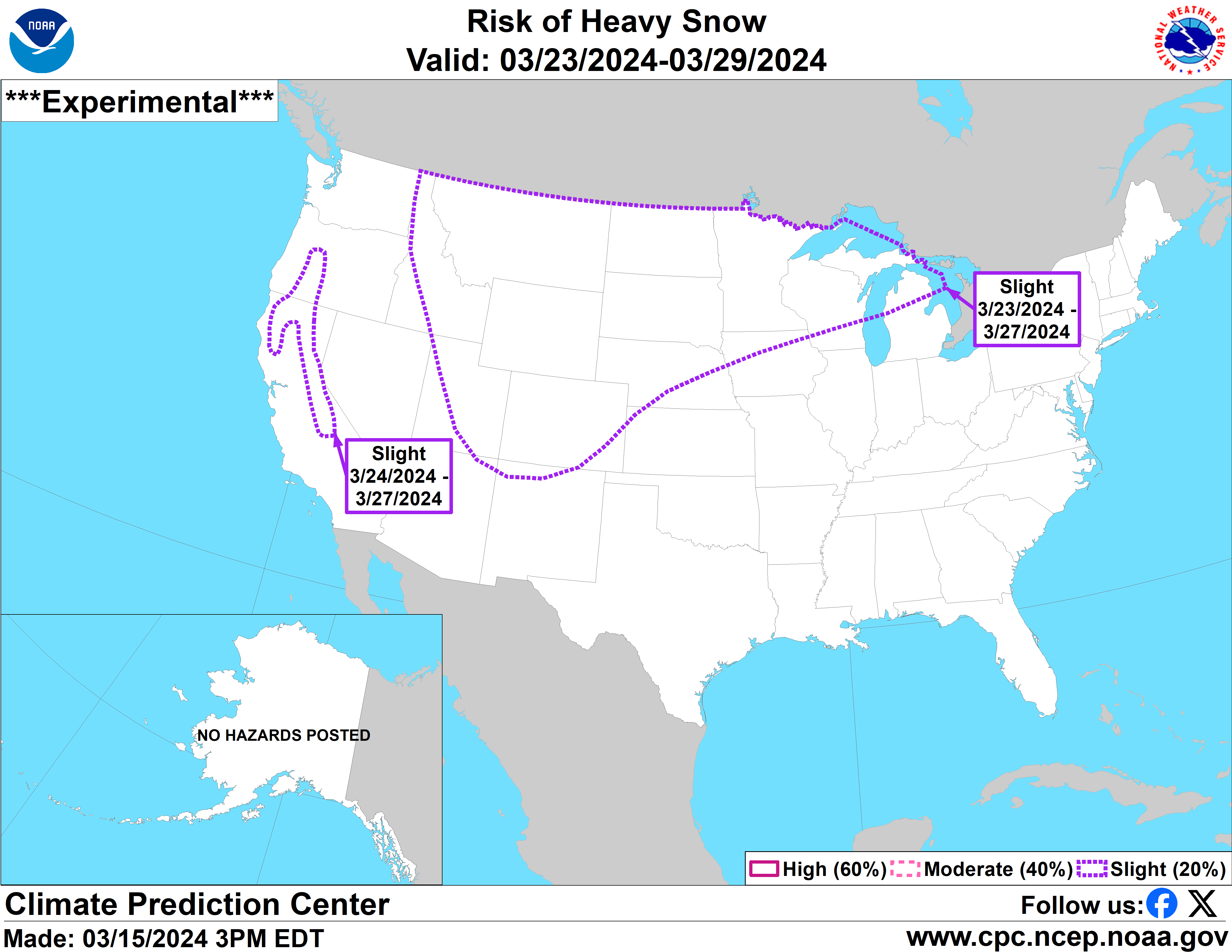
As featured on the forecasting service’s ‘risk of heavy snow’ outlook map, there’s a chance of hazardous heavy snow hitting Colorado from March 24 to March 27, part of a much larger storm that’s expected to span more than a dozen states in middle America.
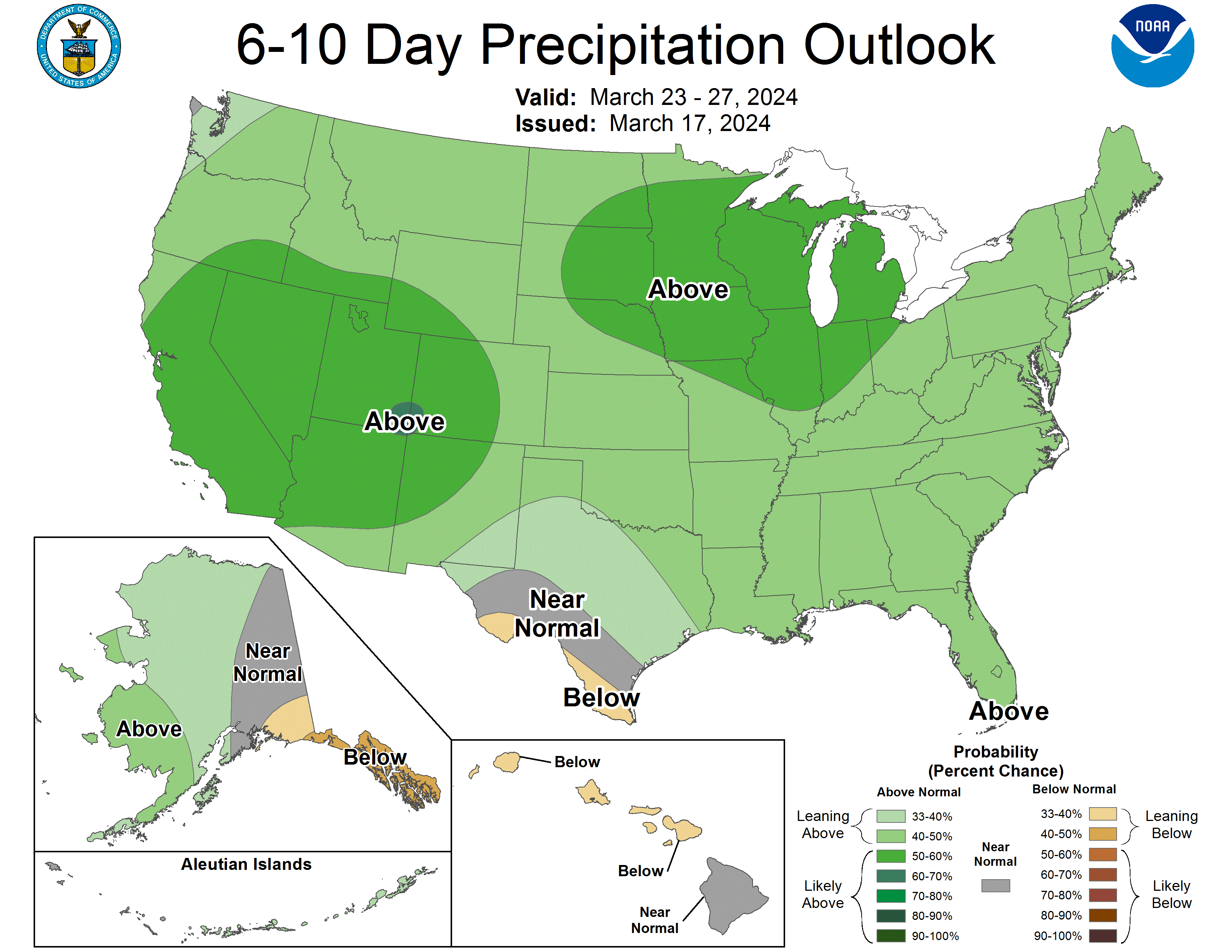
This prediction also aligns with the above-norm precipitation expectation for the same time period, which spans nearly the entire country. As it relates to Colorado, the service is calling for above-norm precipitation for the state through at least April 12.
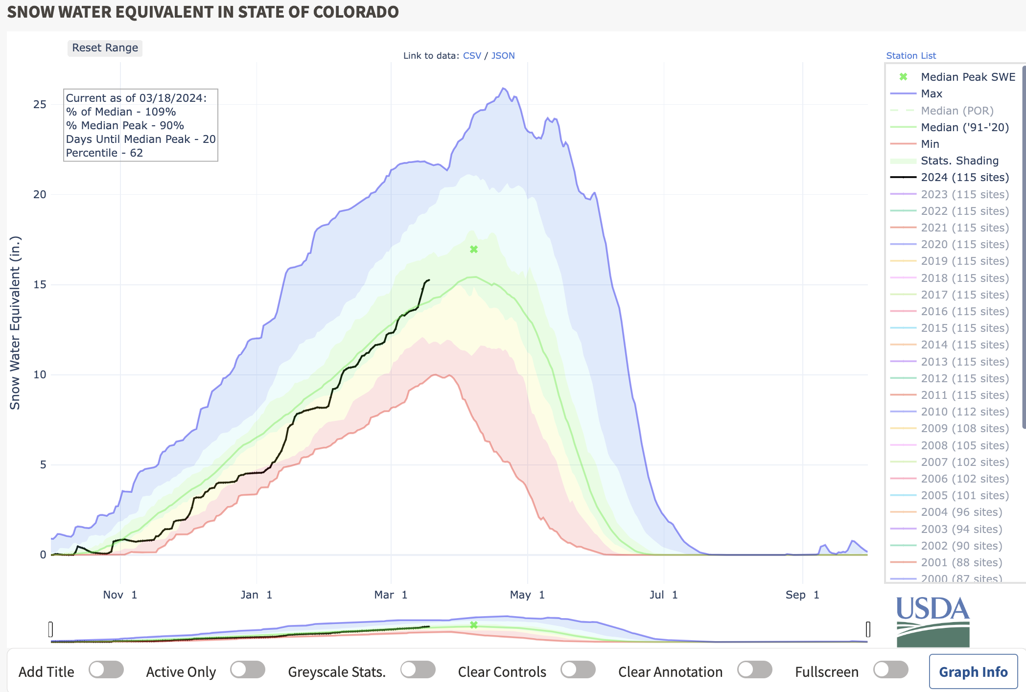
As of March 18, Colorado’s snowpack sits at 109 percent of the to-date norm. The most recent storm pushed the state above the typical to-date snowpack for the first time since the brunt of the state’s snow season got underway.
It’s looking like a wet spring is to be expected in Colorado.
Find additional forecasting updates on the National Weather Service website.
Get OutThere
Signup today for free and be the first to get notified on new updates.
PREV
PREVIOUS

PLAN AHEAD: 6 great spots to find wildflowers this summer in Colorado
Colorado presents an impressive display of wildflowers in the late spring to early summer, with colors and scents spread out across the rugged mountains. July and August are usually the best times to catch the wildflowers at their peak. As you’re planning ahead for summer, here are some of the best places to find wildflowers […]
Colorado's snowpack 'above average' for first time of winter with more snow on the way
It’s officially an above-average snowpack year in Colorado, thanks to a massive storm that walloped the state last week. As snow started falling on Wednesday, Colorado’s snowpack was sitting at about 99 percent of the norm for this time of the year. While snowpack has been fairly close to 100 percent of the norm for […]