


“Difficult if not impossible travel”: Timeline of major snowstorm set to hit Colorado

In case you haven’t heard, a major storm is setting up to hit heavily-populated parts of Colorado from Wednesday morning into Friday morning. With 20-plus inches expected on parts of I-25 and parts of I-70 in the Central Mountain region, there will be major impacts to travel.
Here’s a look at the expected timeline of the storm as it relates to travel, according to the National Weather Service.
Tuesday: No concerns, storm hasn’t started yet.
Wednesday: Road conditions will start to rapidly deteriorate in the Front Range foothills by afternoon, worsening along the I-25 corridor by the evening. This will likely impact the Wednesday commute.
Thursday: Extremely difficult to impossible travel is expected across the Front Range mountains, foothills, and I-25 corridor all day Thursday, into Thursday night. Roads will be slick and snow will be heavy. Avoid travel if possible. Thursday should be the day with the heaviest snowfall – don’t be fooled if lighter totals land on Wednesday night.
Friday: Expect poor travel conditions in the morning, but conditions should get better throughout the day.
Saturday: Travel conditions should be mostly fine. Winter storm watch advisories along the Front Range have expired.
Travel will be dangerous. Avoid travel on Thursday if possible along Colorado’s Front Range metro area.
Follow along with additional weather news from the National Weather Service here.
STAY INFORMED: Get free Colorado news with our daily newsletter (Click here)
Get OutThere
Signup today for free and be the first to get notified on new updates.
PREV
PREVIOUS

Wildfire came 'precariously close' to mountain town homes this week in Colorado
A scary situation unfolded on Willits Lane in Basalt, Colorado on Monday, with a wildfire coming ‘precariously close’ to homes, vehicles, and other structures. According to Roaring Fork Fire Rescue, the mountain town blaze started as a brush pile burn, which eventually spread to dry grasses. When fire crews arrived on the scene, they discovered […]
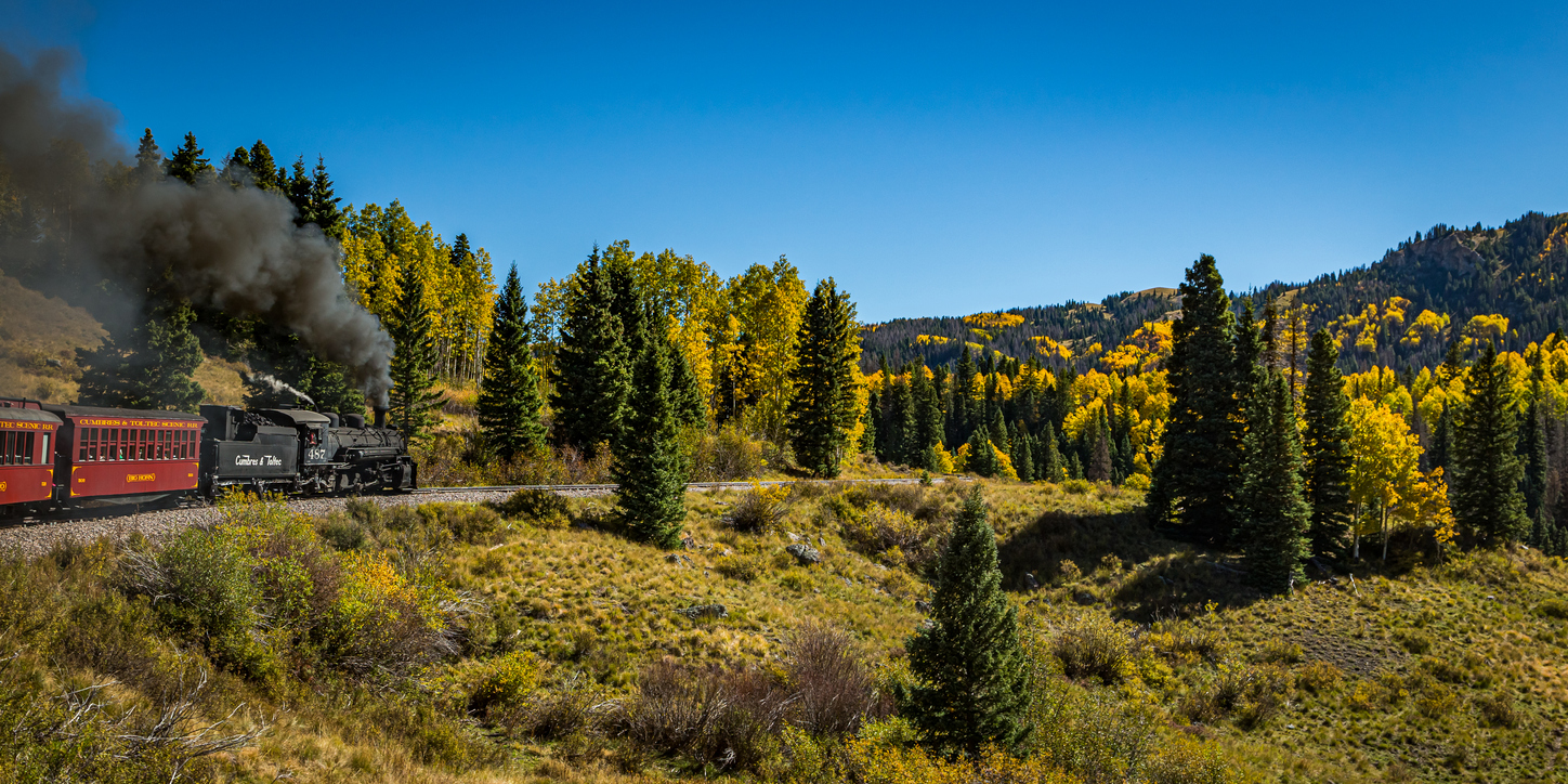
6 historic train rides found around Colorado
These train rides will take you right back to Colorado’s Wild West past, as well as show off the state’s stunning scenery. Here are six historic train rides in Colorado: 1. Cumbres & Toltec Scenic Railroad Not only is this 1880s vintage line a National Historic Landmark on wheels, but it was featured in Indiana Jones […]