


Forecast intensifies to show up to 36 inches of snow and ‘whiteout’ conditions in Colorado
A storm that’s set to hit parts of Colorado’s mountainous terrain has intensified, with even more snow now expected to land between Wednesday morning and Friday morning.
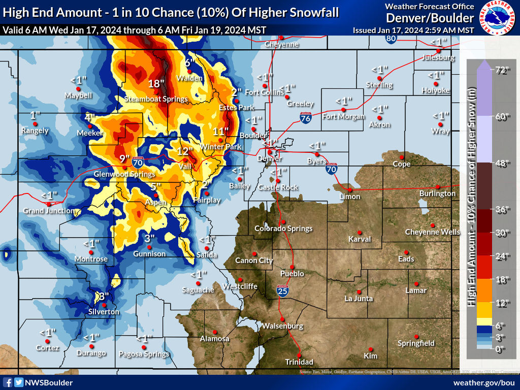
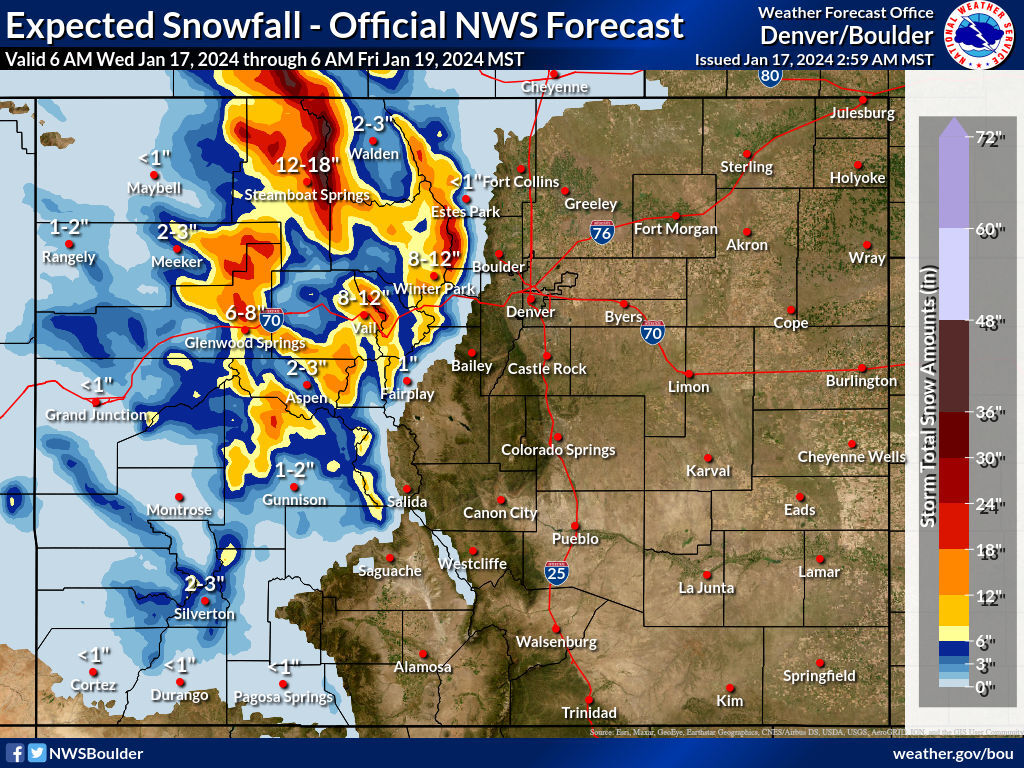
National Weather Service mapping is now showing that up to 18 inches of snow may land in the city of Steamboat Springs, with up to 12 inches in Vail, 12 inches in Winter Park, and eight inches in Glenwood Springs. Perhaps more notable is that some peaks in the Rabbit Ears Pass area may get up to 36 inches, with some peaks near Winter Park expected to get up to 30.
Meanwhile, peaks north of Glenwood Springs, near Vail Pass, and southwest of Aspen may get up to 24 inches.
Those deeper totals get more widespread if the ‘one-in-10 chance’ high-end snowfall scenario takes place. In that case, many of Colorado’s northern and central mountain peaks get at least a foot of snow, with that higher-end accumulation total remaining around 36 inches, but being more widespread.
Heavier snow is set to start on Wednesday afternoon, with driving conditions expected to be poor in impacted areas through at least Thursday. Wind speeds between 55 and 75 miles per hour will result in blowing snow and limited visibility. Whiteout conditions are expected on mountain passes and near and above tree line.
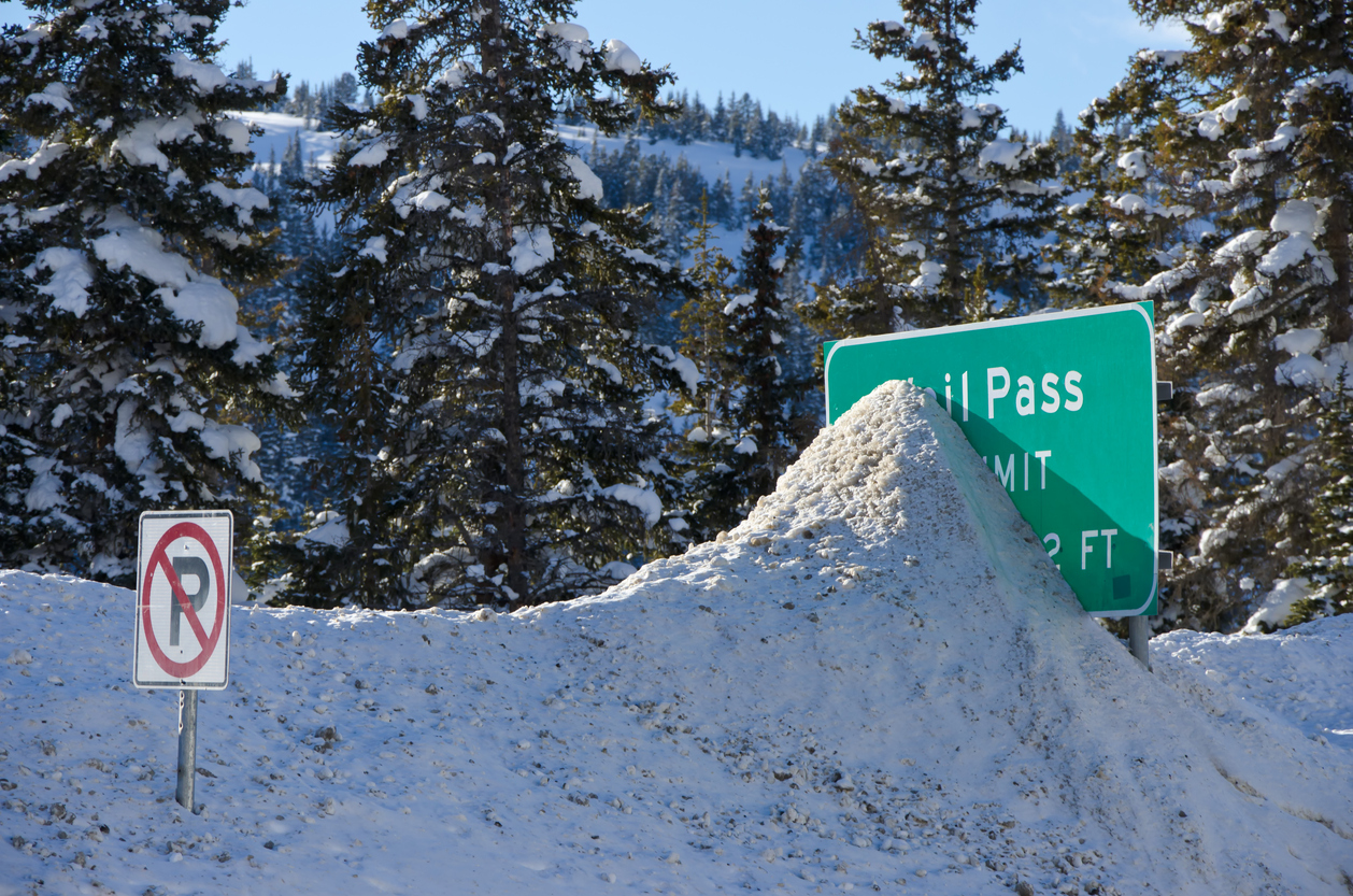
Thanks to a lot of heavy snow that’s already fallen in the past two weeks, there are already lingering concerns with travel in Colorado’s mountainous terrain. As of Wednesday morning, Berthoud Pass and Loveland Pass remain closed. Expect winter-related mountain travel concerns to continue. Pack your trunk with these 16 safety items that could help to save your life should stranding occur.
STAY INFORMED: Get free Colorado news with our daily newsletter (Click here)
Get OutThere
Signup today for free and be the first to get notified on new updates.
PREV
PREVIOUS

Denver weather: Warmer weather welcomed Wednesday, highs near 50
Denver is forecast for warmer weather Wednesday with moderate temperatures in the forecast throughout the week, according to the National Weather Service in Boulder. Expect sunny skies on Wednesday and a high of 49 degrees. Winds from the southwest will roll through the area at 9 mph. Looking ahead to Wednesday night, expect partly cloudy […]
Extended closure in place on major I-70 stretch due to heavy snow
According to a 9 a.m. Wednesday update from the Colorado Department of Transportation, I-70’s Vail Pass portion that is found between Vail and Copper Mountain has been closed for winter maintenance. The Colorado Department of Transportation encourages motorists to use the alternate route consisting of US 24 and CO 9, which travels through Fairplay, Buena […]